Image
New Local Plan
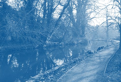
Green and blue infrastructure
Our overall aim is for Merton's open spaces, green infrastructure and nature conservation to be protected and enhanced. We also provide guidance on flood risk management and sustainable drainage, in partnership with the Environment Agency, water companies, developers, neighbouring boroughs and local communities.
| Policy Reference | Policy Name | Summary |
|---|---|---|
| O15.1 | Open space, green infrastructure and nature conservation | This Strategic Policy sets out the overall aims for Merton's open spaces, green infrastructure and nature conservation to be protected and enhanced. |
| O15.2 | Open space and green infrastructure | This policy aims to protect and enhance open spaces in Merton and to improve accessibility to open space. |
| O15.3 | Biodiversity and access to nature | This policy aims to protect and enhance biodiversity, particularly on sites of recognised nature conservation interest, and to improve accessibility to nature. |
| O15.4 | Protection of trees | This policy aims to protect trees and enhance other features of the natural environment. |
| O15.5 | Urban greening | This policy aims to help create healthier places, enhance biodiversity and address the urban heat island effect, through the use of urban greening. |
| O15.6 | Wandle valley | This policy aims to protect the Wandle Valley and maintain it as a strategic, biodiverse and accessible corridor through the borough. |
| F15.7 | Flood risk management and sustainable drainage | This strategic policy sets out how Merton plans to manage and reduce flood risk and help implement sustainable drainage (SuDS across the borough in partnership other risk management authorities. |
| F15.8 | Managing local flooding | This policy sets out how proposed development must ensure there is no increase in flood risk, through provision of appropriate flood risk assessments and mitigation measures. It also requires development to adapt to climate change effects through flood risk mitigation. |
| F15.9 | Sustainable drainage systems (SUDS) | This policy aims to ensure that development includes water efficiency measures to minimise water consumption and SuDS to manage surface water runoff, provide biodiversity, amenity and water quality benefits. |
| P15.10 | Improving air quality and pollution | This policy aims to reduce or mitigate environmental impacts and pollution levels (such as air, noise, light, odour, fumes water and soil) and encourage improvements in air quality, particularly during construction and areas that already exceed acceptable air quality standards. |
Policies Map
| Map | Changes |
|---|---|
| Raynes Park - Policies Map | There have been some proposed changes to the Policies Maps in the Raynes Park neighbourhood. These include MOL, Open Space, SINCs and Green Corridors. |
| Morden - Policies Map | There have been some proposed changes to the Policies Maps in the Morden neighbourhood. These include MOL, Open Space, SINCs and Green Corridors. |
| Mitcham - Policies Map | There have been some proposed changes to the Policies Maps in the Mitcham neighbourhood. These include MOL, Open Space, SINCs and Green Corridors. |
| Wimbledon - Policies Map | There have been some proposed changes to the Policies Maps in the Wimbledon neighbourhood. These include MOL, Open Space, SINCs and Green Corridors. |
| Colliers Wood - Policies Map | There have been some proposed changes to the Policies Maps in the Colliers Wood neighbourhood. These include MOL, Open Space, SINCs and Green Corridors. |
Adoption November 2024
Merton Local Plan chapter 15 Green and blue infrastructure
Local Plan Publication Stage 3 – 22 July to 6 September 2021
Previous consultation documents Stage 2a - November 2020 to February 2021
Maps
- SINCs and Green Corridor Map (Wimbledon and Raynes Park)
- SINCs and Green Corridor Map (Raynes Park and Morden)
- SINCs and Green Corridor Map (Mitcham)
- SINCs and Green Corridor Map (Colliers Wood)
- Open Space and MOL Map (Wimbledon)
- Open Space and MOL Map (Raynes Park and Morden)
- Open Space and MOL Map (Mitcham)
- Open Space and MOL Map (Merton)
- Open Space and MOL Map (Colliers Wood)
- Local Nature Reserves Map (Mitcham and Morden)
- Local Nature Reserves and SSSIs Map (Wimbledon)
- Local Nature Reserves and SSSI Map (Merton)
- Local Nature Reserves (Raynes Park and Morden)
- Wandle Valley Regional Park Map
- SINCs and Green Corridors Map (Merton)